SunGeomatics offer the unique solution that deliver high definition Aerial 3BAND, 4BAND and Monochrome image enchantment process.
An orthophoto, orthophotograph or orthoimage is an aerial photograph geometrically corrected ("orthorectified") such that the scale is uniform: the photo has the same lack of distortion as a map. Unlike an uncorrected aerial photograph, an orthophotograph can be used to measure true distances, because it is an accurate representation of the Earth's surface, having been adjusted for topographic relief, lens distortion, and camera tilt.
Orthophotographs are commonly used in the creation of a Geographic Information System (GIS). Software can display the orthophoto and allow an operator to digitize or place linework, text annotations or geographic symbols (such as hospitals, schools, and fire stations). Some software can process the orthophoto and produce the line work automatically.
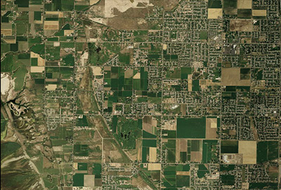
3BAND(RGB) IMAGE PROCESSING
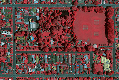
4BAND(RGBI) IMAGE PROCESSING
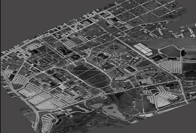
MONOCHROME IMAGE PROCESSING
SATELLITE IMAGE PROCESSING
PANCHROMATIC IMAGE PROCESSING
IMAGE GEOREFERENCING